South West UK
2017-2022
Project Code: 001A
The SWEEP OWWL model is delivering more accurate, site-specific coastal hazard forecasts for the South West. The team worked closely with the Environment Agency to ensure the improved forecasts have real-world application – helping to protect the environment and properties, save lives, and facilitate cost-savings for marine and coastal businesses.
Project team


Case studies
Case studies

Why it matters
The detrimental economic and societal impacts of coastal flooding along the South West’s 1014km of highly indented coastline is exacerbated by increasing demands on coastal use, and the threat of climate change and rising sea levels. Better forecasting can potentially saves lives, protect the environment and property, and help marine businesses and flood-response organisations to operate more efficiently.
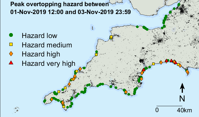
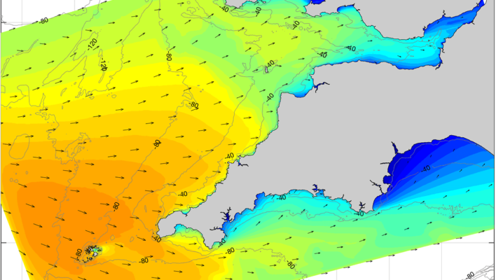
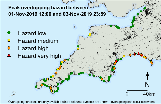
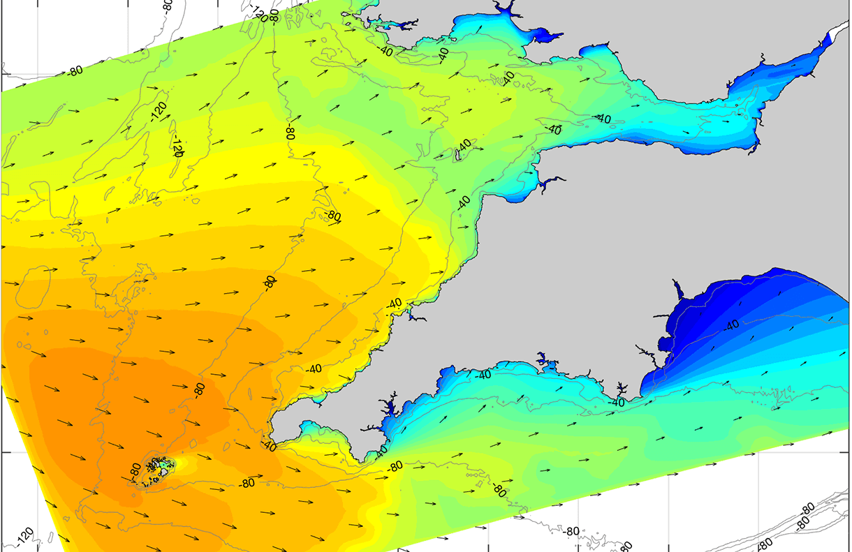
Coastal flooding is normally considered to be the result of high tides and storm surge, but in the South West an important additional factor is ‘wave run-up’. This occurs where large waves hit coastal structures or beaches. The Operational Wave and Water Level Model (OWWL) brought all these factors together.
Previous forecasting models did not include wave-run up and only predicted offshore wave conditions at coarse resolutions. Whilst useful for area-wide application, these predictions are less useful at the local, site-specific level, and where breaking inshore waves create the greatest damage. There was a need to develop more accurate and localised forecasting.
Partners


Prior to having the SWEEP-OWWL forecast we would have had a much wider response, a more reactionary esponse, or perhaps even not have responded at some of the key locations for wave overtopping.
Nick Ely, Environment Agency
What we did
The first version of OWWL was finalised in October 2018 and predicts storm impacts around the South West coastline at a resolution of 1 km. It is delivered daily via the Channel Coastal Observatory (CCO) website, Twitter, and through tailored alert emails providing site-specific, ‘three-day advance’ forecasts of coastal overtopping and flooding hazards. It currently has 70 subscribers, including 19 local EA flood managers who have now used it to inform their decision.
Impacts & benefits
- Improving health and wellbeing – Nick Ely, EA’s Coastal Modelling & Forecasting Manager, confirmed OWWL “has been mstrumental in helping us to make more informed decisions on issuing warnings to the public” and will “safeguard not only the health and wellbeing of coastal communities during storms, but also the wellbeing of our flood response staff around the southwest coast.”
- The development of OWWL has: influenced an attitudinal shift at the EA round the importance of having an overtopping tool as part of their national forecasting strategy; informed a national-level strategic review of the EA’s coastal forecasting strategy, and led to £ 140m of Detra funding with £20m ear-marked for future, enhanced real-time coastal forecasting plans;
- Influenced EA operational practices – South West local flood warning officers use the daily live OWWL wave overtopping forecast to more accurately predict coastal flooding and more effectively target resources; delivered cost savings to the EA through accelerating improvements in forecasting capabilities and more effective resource targeting.
This improvement in resource targeting [as a result of the OWWL model] will have saved the EA thousands of pounds during each of the six largest storms over the last two winters by being able to be more targeted in our working, and educing unnecessary trips and deployments.
Nick Ely, Environment Agency
Looking to the future
Demand for further applications of the SWEEP-OWWl model is growing and the team have already delivered a number of additional projects.