HCaCD
The Habitat Classification tool & Habitat Change Detection tool
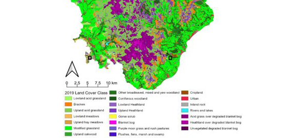
This tool enables consistent, and annually repeatable, mapping of habitats across the extent of Dartmoor.
Links to the tool and habitat maps can be viewed in this paper.
The full reproducible code and input data can be directly accessed here.
The maps and data tables produced from this tool can be accessed here.
Please note that both the tool and the maps are released under a non-commercial share alike creative commons license (CC BY-NC-SA 4.0).
If used, please credit Naomi Gatis’ paper as above.