
OWWL
Operational coastal Wave and Water Level model
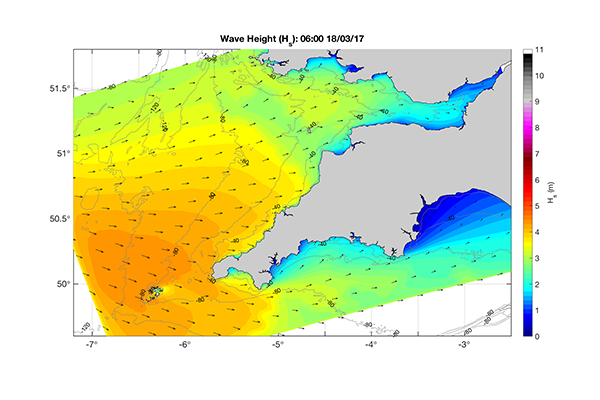
OWWL is a forecasting system designed to predict waves, water levels, and wave overtopping hazard around the South West coast of the UK.
The model is updated once a day, and provides three-day forecasts. The system uses a 1-km resolution hydrodynamic (wave, currents, and water levels) Delft3D model, which is forced by a larger Met Office model, providing 2D spectral wave data, water levels, and currents along the four model boundaries, and the entire domain is forced with gridded wind and pressure data at 7-km resolution.
A regional overview showing the maximum predicted hazard over the 3-day
forecast period is published daily on the @Coastal_Hazards Twitter account.
Watch a fly-through of the model, and learn about how it is powered and the forecasts it can generate here.